Screencapped from Google Maps, 2007.
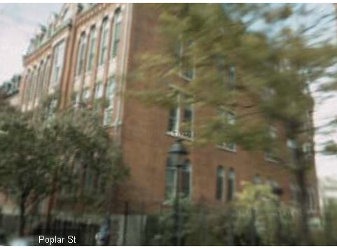
The following are all images from Google Maps' then-new "Street View" feature. As with all views using this feature, there is some distortion of the image.The front of the building is heavily blocked by trees, so it was difficult to get very clear shots. The front door, from Poplar Street. View is tilted up as much as feature will allow, to show 2nd-floor windows. Note the extreme distortion of the image, even though the "viewer" is standing right in front of the building. Because the original image is dark and indistinct, I brightened it.
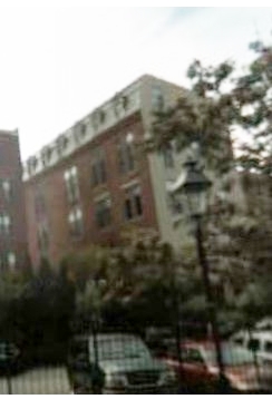
Looking at the northeast corner, one of the back corners of the building. Note that the north face of the building (which is the back wall) is a uniform pale color that doesn't match the red brick of the other exterior walls. I don't know whether the original back wall had this appearance or not. Given that in present-day, the building shares the same address (55 Poplar) as some of the adjoining buildings (see the overhead Google Earth screencap above), it's possible it has been altered.
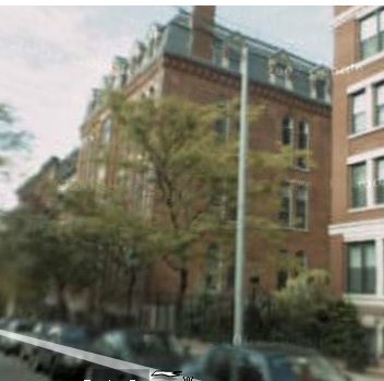
The east wall (the one with a row of small attic windows) originally faced an alley. Another brightened image. This is looking at the NE corner again, but from farther east, so we see more of the east wall. You also get a rough (given the distortion) idea of how close the LH is to the Brooklyn Bridge. In this shot, the footprint of the building looks almost square (i.e., the east wall looks almost as short as the south (front) wall), but if you compare it to the overhead Google Earth screencap, you'll see this is not true. According to the building measurements taken in 1899, the LH is nearly twice as deep as it is wide. Similar to the above shot, but from farther east on Poplar St., to get a better view of the building. Similar to the first shot from Halstead above.